

 Terra Pulse Technical Team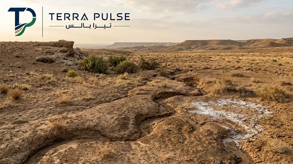
Understanding the causes of land degradation starts with two questions: What function has the land lost, and what caused that loss? This guide explains the main drivers, shows how to distinguish common warning signs, and outlines the information needed before choosing a prevention or rehabilitation plan.
What Is Land Degradation, and How Is It Different from Soil Degradation?
Land degradation is a decline in a site’s ability to perform its environmental or productive functions. These may include supporting vegetation, absorbing and regulating water, maintaining a stable surface, or sustaining an appropriate land use. The decline can result from changes in soil, vegetation, drainage, or several factors acting together.
Soil degradation refers more specifically to damage to soil properties. Examples include erosion, salinity, compaction, declining organic matter, and contamination. Soil is therefore one part of the wider land system. Assessing a degraded site may require examining its soil, plant cover, water movement, and past and present uses rather than relying on a single soil sample.
In short: Soil degradation can drive land degradation, but land can also lose function through changes in vegetation or water movement across the site.
What Are the Main Natural and Human Causes of Land Degradation?
The drivers of soil and land degradation rarely act in isolation. Heavy rain may cause more severe erosion where vegetation has been removed. Drought may amplify the effects of repeated grazing. Irrigation on poorly drained land may contribute to salt accumulation. The main drivers can be grouped as follows:
- Climate and weather: Prolonged dry periods, wind, and intense or irregular rainfall that generates surface runoff.
- Land use and site activity: Vegetation removal, excessive grazing, changes in ground levels, and frequent movement of heavy vehicles or equipment.
- Water management: Irrigation practices unsuited to the site, inadequate drainage, or changes to natural stormwater flow paths.
- Existing site conditions: Soil texture and depth, slope, infiltration capacity, and the ability of the ground to support plant growth.
- Potential environmental impacts from operations: Spills or accumulated materials in working and storage areas, where investigation confirms that the site has been affected.
The presence of a possible driver does not prove it is the main cause. For example, equipment may operate on a site while a patch of declining vegetation is actually linked to irrigation or salinity. A useful assessment connects each suspected cause to an observation or test that can confirm or rule it out.
How Does Soil Erosion Lead to Land Degradation?
Soil erosion occurs when wind or moving water carries soil away from its original position. A site becomes more vulnerable when its surface is exposed, its slope concentrates runoff, its soil has been disturbed, or protective vegetation has declined.
Warning signs include rills or channels, exposed plant roots, sediment collecting at the bottom of slopes, and dust or soil repeatedly moving into nearby roads or facilities. The loss of surface soil can reduce the ground’s ability to retain water and support vegetation. Deposited sediment may also disrupt drainage elsewhere on the site.
Addressing erosion begins by identifying where the soil movement starts and where the material goes. Depending on site conditions, the response may involve managing runoff, stabilizing an exposed surface, limiting disturbance, or restoring suitable vegetation. A photograph alone is not enough to select a measure where slopes, drainage channels, or nearby assets may be affected.
Soil Salinity: How Are Irrigation and Drainage Involved?
Soil salinity develops when salts accumulate to a level that affects plant growth or the intended use of the land. Irrigation water quality, high evaporation, inadequate drainage, and shallow groundwater can all play a role, depending on the site.
A pale crust or uneven plant growth may raise concern, but appearance alone cannot confirm salinity or establish its severity. Similar symptoms may result from water stress or root problems. Representative soil testing, together with a review of irrigation water and drainage where relevant, helps determine whether salts are present and where they are concentrated.
Increasing irrigation is not an automatic solution. If water cannot move adequately beyond the root zone, applying more water may fail to resolve the cause. The appropriate response depends on understanding where the salts come from and how water moves through the site.
How Does Vegetation Loss Accelerate Land Degradation?
Vegetation helps shield soil from wind and the impact of raindrops, while roots contribute to surface stability. Plant cover also affects water movement and conditions at the soil surface. When that cover declines, exposed ground may become more vulnerable to erosion, especially if the pressure that caused the loss continues.
Vegetation loss can be linked to drought, repeated grazing, construction activity, salinity, or plants that are poorly suited to local soil and climate. Replanting before identifying the cause can lead to repeated failure. Drought-tolerant species alone will not solve persistent waterlogging, just as a new irrigation system will not protect an area that remains exposed to heavy vehicle movement.
A restoration plan should define its purpose first. Is the priority to stabilize soil, support the recovery of native vegetation, or establish managed planting around a facility? Plant selection, irrigation, maintenance, and measures of success will differ for each objective.
What Roles Do Drought, Overgrazing, and Land-Use Change Play?
Drought can reduce plant growth and recovery, making other pressures more visible. However, vegetation decline during a dry period does not prove drought is the only cause. Grazing intensity, site protection, and water management may also affect the outcome.
Overgrazing can limit plant regeneration and leave areas exposed, particularly when the same locations face repeated pressure without time to recover. Changes in land use, such as grading, opening vehicle routes, or clearing plants, can alter the movement of water and sediment even when the physical works cover only part of a site.
For construction and development sites, prevention should be considered during the works: define movement and storage areas, manage stormwater, protect areas outside the work zone, and inspect the surface after completion. Where appropriate to the project scope, these measures can be organized within an environmental management plan.
Comparison: How Do Common Forms of Land Degradation Differ?
The comparison below helps organize possible causes before a technical assessment. A visible sign guides the investigation; it does not confirm a diagnosis on its own. More than one form of degradation may be present at the same site.
| Type | Possible warning signs | What should be checked? | Potential response |
|---|---|---|---|
| Soil erosion | Rills, exposed roots, and sediment accumulating below slopes. | Runoff routes, slope conditions, vegetation cover, and the source of moving soil. | Manage runoff and stabilize the surface using measures suited to the site. |
| Soil salinity | Possible surface crusts and weak or uneven plant growth. | Soil and irrigation-water results, drainage performance, and salt distribution in the root zone. | Address the source of salt accumulation and review irrigation and drainage before selecting treatment. |
| Vegetation loss | Expanding bare areas and plants that do not recover or regenerate. | Site history, grazing or traffic pressure, water supply, plant suitability, and soil condition. | Remove the continuing pressure and select an appropriate revegetation approach. |
| Soil compaction | Ponding, slow infiltration, limited root growth, or repeated equipment tracks. | Vehicle routes, soil structure, infiltration, and the depth and extent of the affected layer. | Manage traffic and improve soil conditions using measures shown to suit the site. |
| Suspected contamination | A history of spills or material storage; visible signs may be absent. | Operational history, potential sources, affected media, and sampling and laboratory results. | Assess site risks, compare containment or treatment options, and verify the outcome. |
This table is a guide to the differences between conditions, not a ready-made remediation plan. For example, weak vegetation may coincide with salinity and compaction. In that situation, the assessment should identify the primary constraint and supporting factors so that one intervention is not undermined by an unresolved problem.
What Warning Signs Can Reveal Land Degradation on a Site?
Look for a pattern of change, rather than a single isolated symptom. Does the problem occur only on slopes? Is it concentrated near irrigation lines or equipment routes? Did it appear after a change in site use? These questions offer more useful direction than describing the ground simply as “dry” or “unsuitable for planting.”
- At the surface: Rills, crusting, cracking, moving sediment, or bare areas that expand over time.
- In water movement: Unexpected ponding, rapid runoff, a new flow path, or areas that remain wet longer than their surroundings.
- In vegetation: Declining cover, weak growth in defined patches, or a failure to regenerate during a suitable growing period.
- In the site record: Excavation or filling, irrigation changes, vehicle movement, or incidents that warrant further investigation.
Record where and when each sign was observed and photograph it from consistent locations where possible. Separate direct observations from suspected explanations. This basic record can improve the next inspection and help target measurements or samples.
How Should the Degree of Degradation Be Assessed Before Choosing a Solution?
No single test answers every land-degradation question. The assessment scope depends on the site’s intended use, the signs observed, and the decision the project needs to make. A practical process has five stages:
- Define the site’s function: Is it rangeland, a natural area, agricultural land, or part of an industrial or infrastructure project? The intended function shapes what a successful outcome means.
- Review site history and available information: Examine previous uses, vegetation changes, drainage and irrigation plans, incidents, and existing test results.
- Inspect and map the affected areas: Document runoff routes, erosion features, differences in plant growth, and the boundaries of the observed problem.
- Select relevant tests: These may address soil properties, salinity, water, and vegetation. A justified concern about contamination requires a separate investigation designed for that question.
- Set a baseline and measurable objective: Record conditions that can be compared later, such as exposed area, surface stability, vegetation cover, or relevant analytical results.
Changes in land cover, land productivity, and soil organic carbon can help show broader degradation trends. However, mapped or remotely observed information still needs field verification when a decision concerns a specific site. Terra Pulse’s environmental monitoring and measurement service describes how measurement and sampling scopes are linked to site conditions and potential impact sources.
How Can Land Degradation Affect Productivity and Biodiversity?
Effects vary with the land type and severity of degradation. Some sites lose the ability to support plants or absorb water effectively. Others experience reduced vegetation regeneration or a decline in the cover that supports local species. Sediment carried by runoff may also affect areas beyond the original erosion point.
Success cannot be measured by the number of plants installed alone. If plants fail to persist, or erosion returns after the next major rainfall, the site’s function may not have improved sufficiently. A rehabilitation plan should therefore connect soil, water, and vegetation conditions to outcomes that can be checked after implementation.
How Can Land Degradation Be Prevented or Reversed?
An effective plan first addresses the continuing cause, then selects measures that fit the site’s condition and intended use. Depending on the assessment, the approach may include:
- For erosion-prone land: Review runoff routes and surface stability, reduce exposure, and select suitable soil-stabilization measures.
- For saline soil: Review irrigation water, drainage, and analytical results before deciding how the site should be managed.
- For vegetation loss: Remove the pressure causing the decline, choose suitable plants, and define establishment, irrigation, and maintenance requirements.
- For land affected by site works: Control vehicle movement and review grading, backfilling, and stormwater drainage within the project’s scope.
- For suspected contamination: Identify potential sources and affected media, investigate the extent, assess risks, and select a response based on the findings.
How can Terra Pulse support this process? Its published services include environmental consulting and studies, environmental monitoring and measurement, and contaminated-site assessment and remediation. The company also describes civil works that include site preparation and stormwater drainage, as well as planting, irrigation, and landscape services. The appropriate scope depends on the actual site conditions; a degraded site does not automatically require every service.
For a site with suspected contamination, Terra Pulse’s service page describes a process involving review of site history, investigation and sampling, risk assessment, comparison of treatment options, and verification. Land affected by erosion or vegetation decline without evidence of contamination needs an assessment built around its own likely causes rather than an assumption that pollutants are present.
When Does a Site Need a Specialist Assessment?
A specialist assessment becomes particularly useful when the affected area is expanding, the problem returns after attempted repairs, or degradation occurs near a slope, drainage route, facility, or other asset. It is also important where site history suggests a possible spill or industrial impact, because surface appearance alone cannot establish the extent of contamination or the right response.
Before requesting an assessment, gather the site’s location, its current and previous uses, dated photographs, when the issue first appeared, the source of irrigation water if relevant, and any available drawings or test results. These details help define the technical question, site visit, and testing scope.
Seeing signs of degradation at a site you manage? Share the available details with Terra Pulse through its contact page to discuss an appropriate assessment scope and next step.
Frequently Asked Questions About Land Degradation
What is the difference between the causes of land degradation and soil degradation?
Soil degradation concerns changes to soil properties, such as erosion, salinity, or compaction. Land degradation covers their wider effects along with vegetation, water movement, and the site’s ability to perform its intended function.
Can land recover after vegetation has been lost?
Many sites can improve, but the outcome depends on why the vegetation disappeared and whether that pressure has been addressed. Recovery planning should consider soil, climate, water, suitable species, and follow-up monitoring. No single timeframe applies to every site.
How can I tell whether a site has salinity or erosion?
Rills, sediment deposits, and exposed roots may indicate erosion. Surface crusting and uneven plant growth may raise concern about salinity. These are preliminary signs: salinity requires suitable testing, while erosion assessment should examine where soil and water are moving.
What is the first step in restoring degraded land?
Document the problem and review the site’s use and history, then investigate the likely cause before selecting a treatment. Once the cause is understood, set a measurable objective and a way to check whether the intervention has worked.
Conclusion
The causes of land degradation include erosion, salinity, and vegetation loss, often alongside drought, grazing pressure, soil compaction, or changes in land use. The most useful approach is to identify how these factors interact, establish a baseline, address the continuing cause, and measure the result after work is completed. If your site needs assessment, you can share its details with Terra Pulse to discuss a suitable scope of work.
Technical References
- United Nations Convention to Combat Desertification: Definitions of land and land degradation.
- UNCCD: Good practice guidance for monitoring land degradation.
- Food and Agriculture Organization: Irrigation water quality, salt accumulation, and drainage.
- USDA Agricultural Research Service: Effects of soil compaction.
